Fragile Past, Digital Future
How two heritage projects are safeguarding present — and future — archaeological sites thanks to generous funding by Arcadia


Protecting the past, present and future of archaeological heritage and landscapes is by no means an easy feat, wherever you are in the world.
To do so effectively requires a thorough knowledge and cataloguing of the environment and the monuments and sites that sit nestled in a region’s history.
Growing populations and growing economies create pressure on land and land-use, but this in turn threatens cultural heritage in many ways.
Two projects funded by Arcadia are working with heritage practitioners and researchers to transform how known and newly discovered archaeological sites and monuments are documented and managed.

Mapping for an unknown future
In the digital age, many tools can be used to facilitate the documentation and management of archaeological heritage, and these projects are using a range of methods to create geospatial databases of archaeological heritage that will be publicly accessible while offering protections to the most vulnerable sites, enabling them to be managed in the system by local heritage experts.
“The aim is to record sites in advance in the possibility that they will be endangered through either the activities of deliberate destruction for ideological reasons or commercial reasons or as a consequence of uncontrolled, unmonitored, infrastructure or urban development, climate change, or other kinds of pressures,” explains University of Cambridge Professor Paul Lane, who is leading the initiative Mapping Africa’s Endangered Archaeological Sites and Monuments (MAEASaM) that is collaborating with stakeholders in eight countries — Mali, Senegal, Sudan, Ethiopia, Kenya, Tanzania, Zimbabwe and Botswana.

“We are treating every single archaeological site as potentially endangered because a significant number of them are not in a digital database, that can be referenced and accessed quickly by the heritage authorities in the planning process.”
Heritage documentation across sub-Saharan Africa is rich and complex, but remains primarily in paper format, making it vulnerable to permanent loss through events such as fire and flood. Transforming paper records into digital assets will make accessing the information they contain easier.


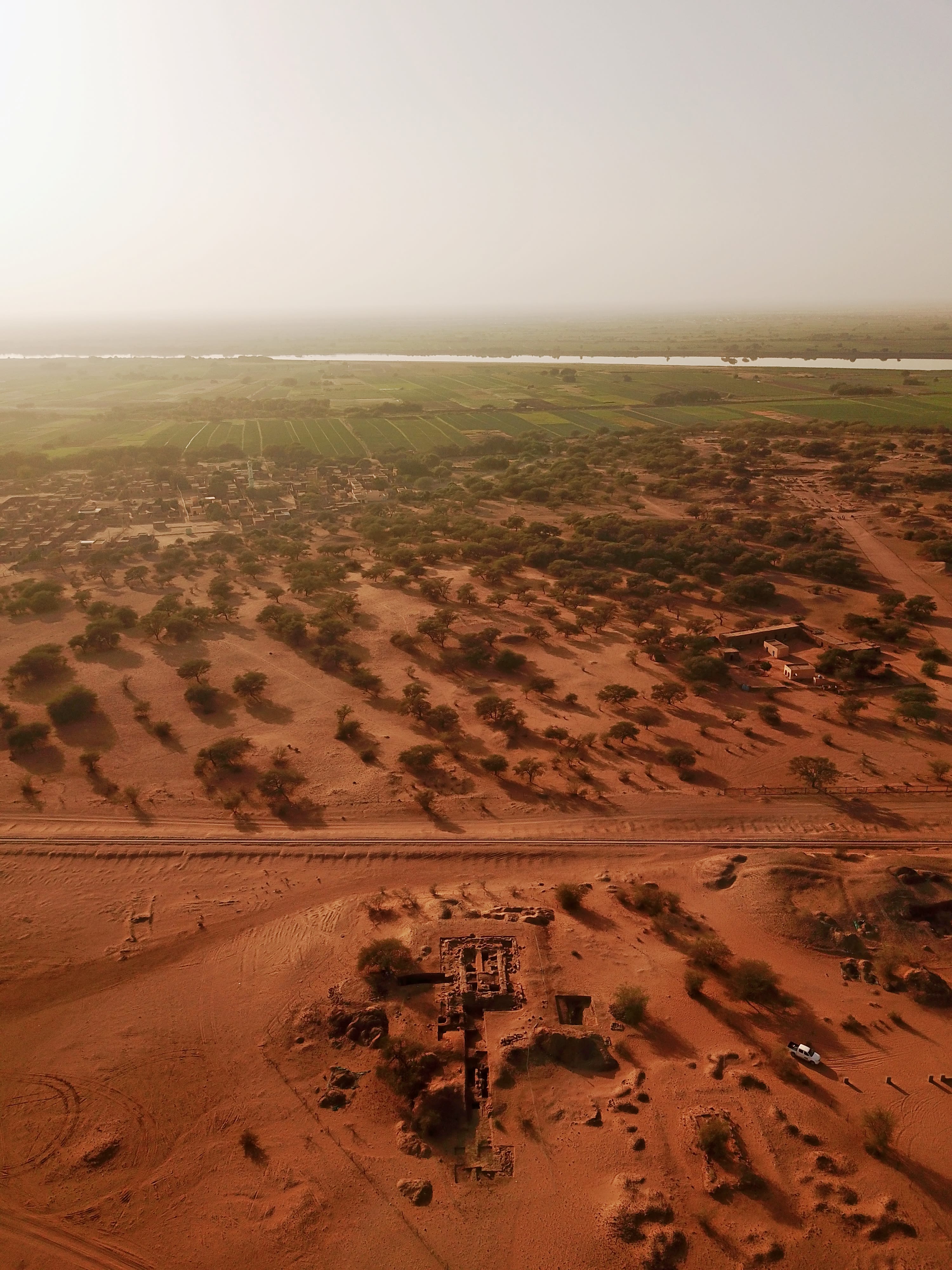
The Apedemak Temple at the Royal City of Meroe, Sudan under excavation in the spring of 2018. Extensive cultivation on the banks of the Nile is visible. Photograph: Frank Stremke.
The Apedemak Temple at the Royal City of Meroe, Sudan under excavation in the spring of 2018. Extensive cultivation on the banks of the Nile is visible. Photograph: Frank Stremke.
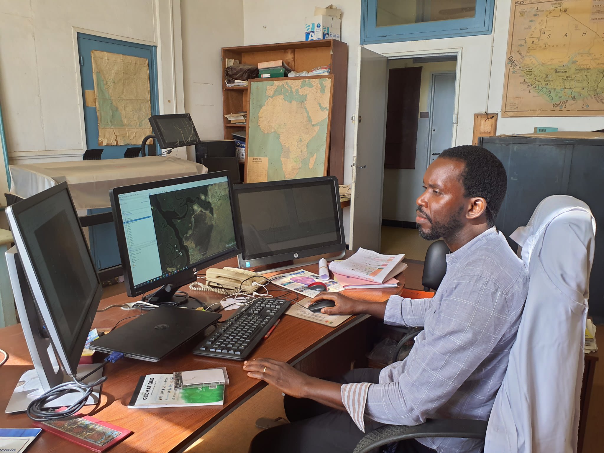
MAEASaM colleague Nicolas Sagna from Cheikh Anta Diop University looking for sites using Google Earth and using QGIS to mark detected sites.
MAEASaM colleague Nicolas Sagna from Cheikh Anta Diop University looking for sites using Google Earth and using QGIS to mark detected sites.

Documenting the endangered archaeology and cultural heritage of the Indus River Basin
Professor Cameron Petrie, who is overseeing the Mapping Archaeological Heritage in South Asia (MAHSA) project, explained why bringing all the relevant data together is so critical.
MAHSA’s work focuses on the Indus River Basin, which is a geographical area stretching across one million square kilometres of Pakistan and north-west India that has seen the rise and fall of many ancient and more recent states and empires.

“This initiative is important academically because researchers want to know a fuller picture about the cultural history of particular places, and they want to understand how things have changed over time,” said Professor Petrie.
“At one level, MAHSA will provide a lot of core data that can be used by academics to understand what happened in the past, but that is only a part of the picture.
“At another level, both India and Pakistan have departments of archaeology and cultural heritage, and it is their job to monitor cultural heritage and, if necessary, protect it.
“So they need to be aware of where archaeological heritage sites are and be in a position to respond when threats arise. At the minute, we’re conscious that both academics and heritage practitioners only actually have a partial understanding of exactly what is out there. So, in fact, we are all missing things. That has an impact on academic research and also the documentation and preservation of cultural heritage.
“Beyond that, is the significance to the public. Both India and Pakistan have very rich cultural heritage and the populations of both of those countries are very actively engaged in their own heritage, and there is a great deal of groundswell interest in terms of what happened during particular periods of history.”

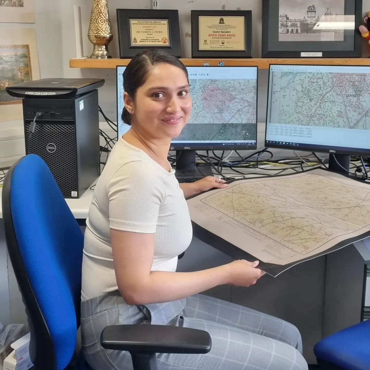
Mous Sarmah, Research Assistant at MAHSA
Mous Sarmah, Research Assistant at MAHSA
Professor Lane adds: “The digitisation is being done for two reasons. First, we’re making security copies of those records so that information is not lost because they are very fragile, increasingly.
“The second element of entering that information into the database is to allow the national authorities to identify the range of archaeological sites that have been recorded for the country, their diversity, identifying gaps in spatial coverage of the country, identifying gaps in terms of the temporal range."
Levels of meaning and reframing histories
The databases of both projects have the potential to be used by different audiences, including local communities, to celebrate and protect archaeological heritage sites. In many cases, these communities are already the stewards of the sites.
These projects also have the capacity to draw attention to aspects of regional heritage that are not widely known internationally and are different to the more common, current global narratives.
Professor Lane used the example of Mali, which has an ongoing armed conflict.
“By creating a digital database and a public-facing platform that highlights the richness of Mali’s archaeological heritage, I think you are giving an important message internationally that there is more to Mali than just ongoing, continuous conflict, insecurity, poverty and climate change,” he said.
“You can demonstrate that there were very vibrant societies, internationally connected through trading networks, complex societies with different levels of social organisation, very historically rich craft industries, etc.”
It is important to articulate the meaning in this context of a site or monument, and how the work is being carried out.
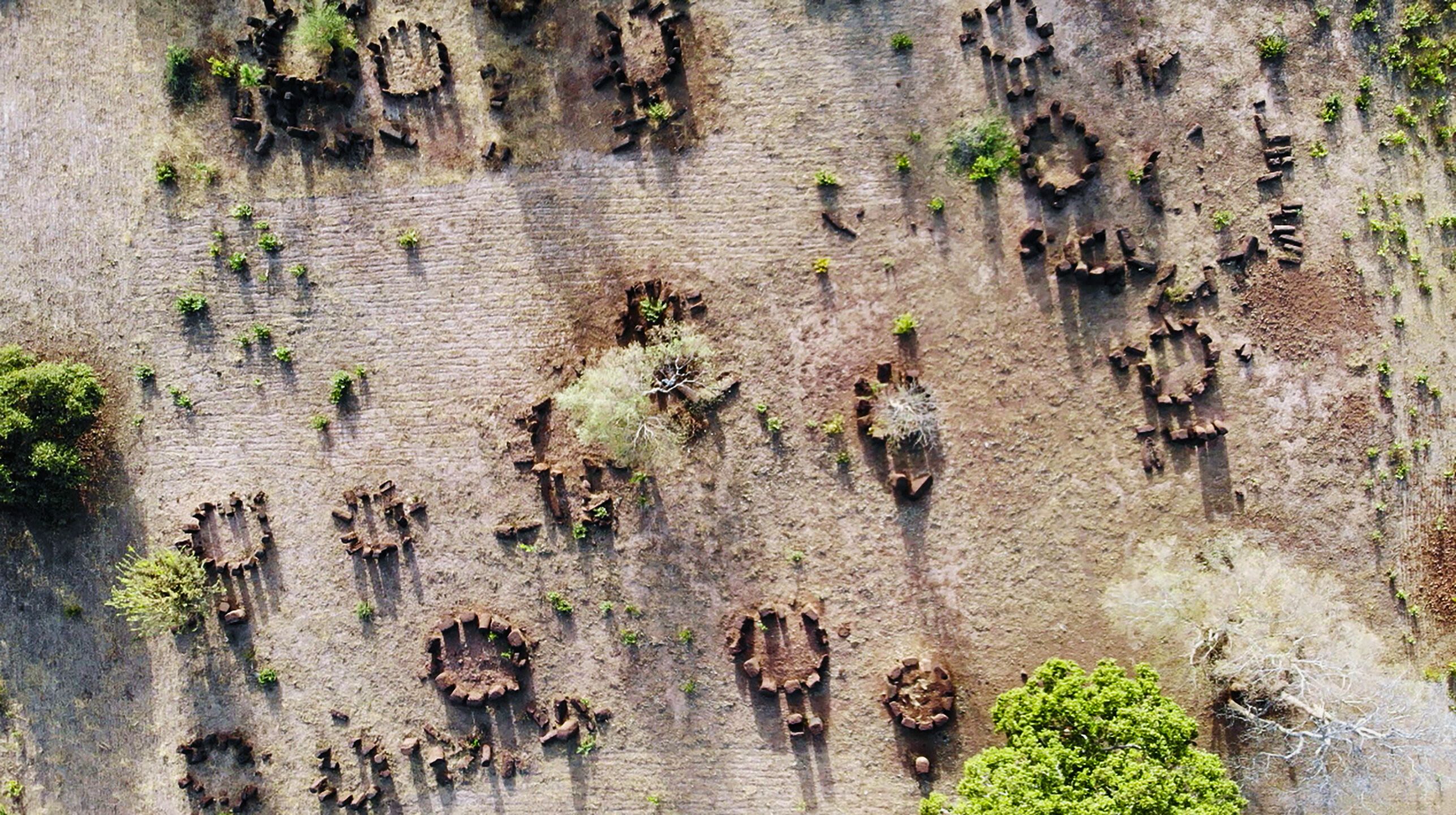
A site could be a large monument with clearly defined boundaries, such as Gedi on the east Kenyan coast, which is a Swahili-era town. It could be an earthwork comprised of bank and ditch enclosures; a surface scatter of pot sheards; a stone cairn, for example, a human-made stack of stones raised for a purpose as a marker or as a burial mound; rock art; a cave; an ancient megalith, similar to Stonehenge; or earthen mounds that may mark out a burial site or a former settlement.
MAHSA and MAESaM project researchers are using a range of methods to catalogue the sites and create the databases, including georeferencing, historical maps, digitisation of existing legacy data and paper records, accessing resources from Google Earth, NASA, the US Geological Service, the European Space Agency and decommissioned spy satellite photographs, also verification by collaborators on the ground.

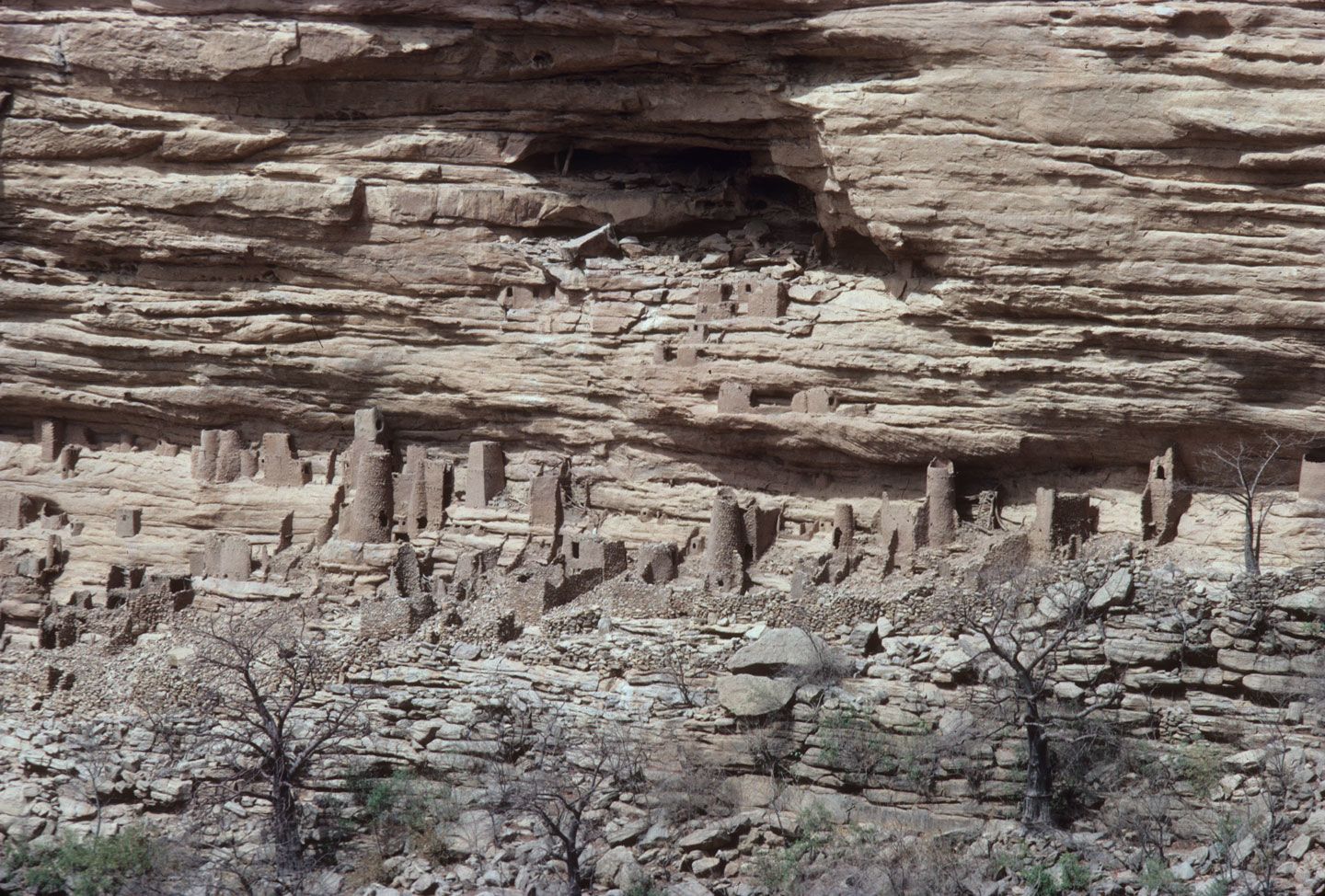
Ancient Toloy-Tellem granaries, tombs and other structures built from coiled clay and stone are visible at many points along the Bandiagara Escarpment, Mail, as here above the village of Banani; the earliest were built between the 5th century BCE and 1st century CE, and were reused and added to until the 14th century CE. Photograph: Paul Lane.
Ancient Toloy-Tellem granaries, tombs and other structures built from coiled clay and stone are visible at many points along the Bandiagara Escarpment, Mail, as here above the village of Banani; the earliest were built between the 5th century BCE and 1st century CE, and were reused and added to until the 14th century CE. Photograph: Paul Lane.
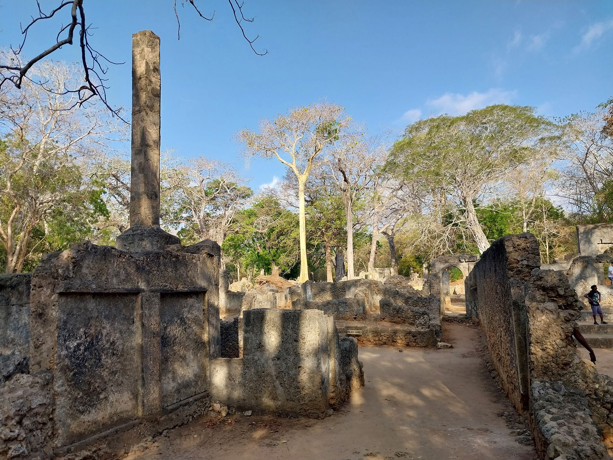
Pillar tomb and palace area, Gedi, Kenya, which was occupied between the 12th and 16th centuries CE. Photograph: Angela Kabiru.
Pillar tomb and palace area, Gedi, Kenya, which was occupied between the 12th and 16th centuries CE. Photograph: Angela Kabiru.
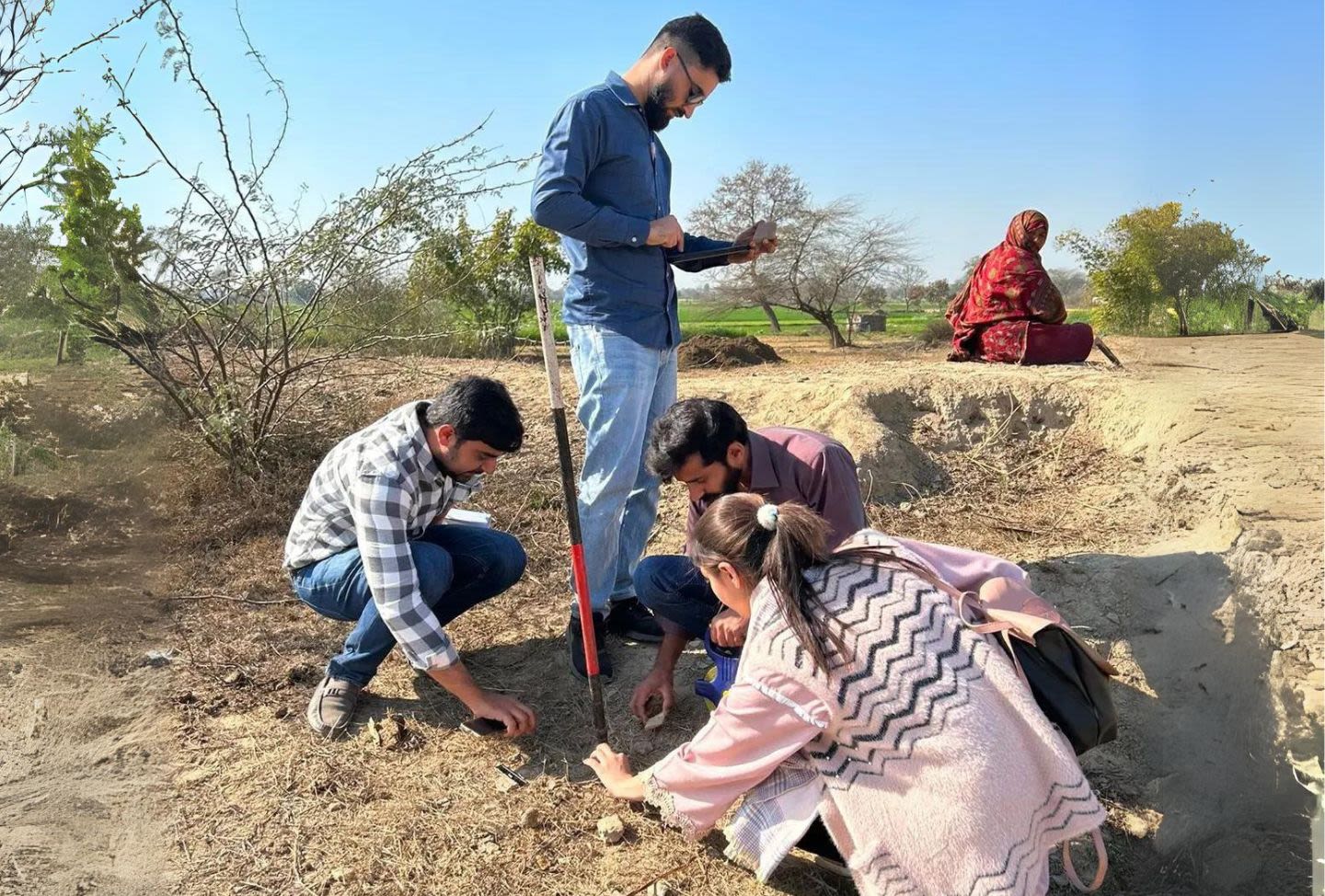
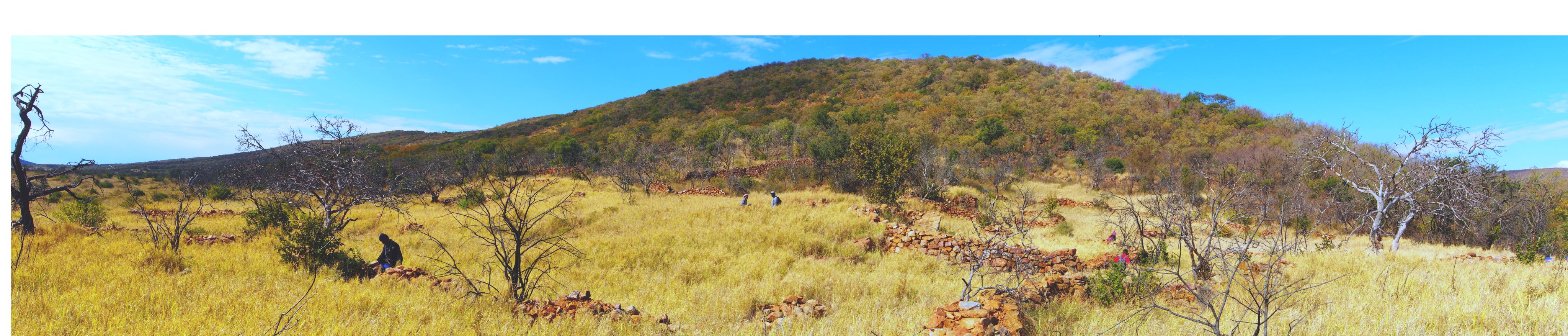
Photographing, measuring and taking notes in the field near Lahore, Punjab.
Photographing, measuring and taking notes in the field near Lahore, Punjab.
An ongoing dialogue with history — and the future
Both projects have already made some eye-catching and breathtaking discoveries.
Professor Petrie uses the example of Mohenjo-daro, a famous archaeological site in Pakistan established around the 26th century BCE. It was the largest settlement of the ancient Indus Civilisation and was one of the world's earliest major cities. It is a UNESCO World Heritage Site, the first site in South Asia to be so designated.

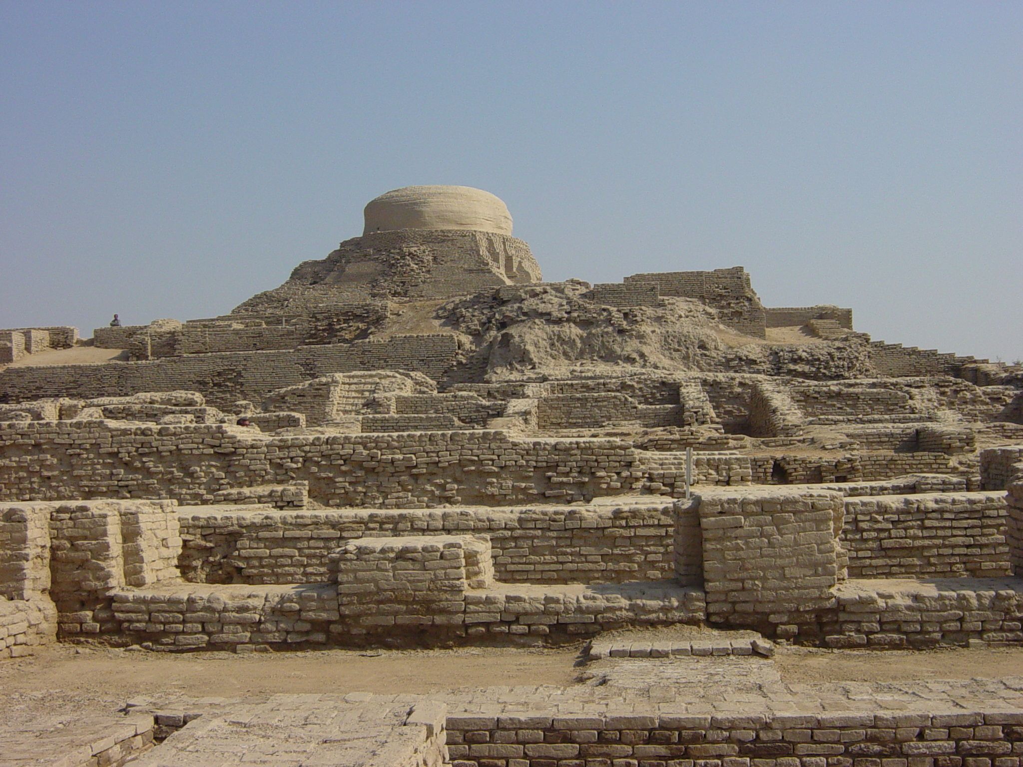
Archaeological Ruins at Moenjodaro, Pakistan. Photo: Junhi Han
Archaeological Ruins at Moenjodaro, Pakistan. Photo: Junhi Han
It was first reported by an archaeologist in 1911, who “didn’t think it was particularly interesting, as he thought it was a historical site,” explains Professor Petrie.
“Then, a whole string of eminent archaeologists worked there and demonstrated that it was a really significant site.
“We went back to some of the original reports and were able to establish that it was first documented a decade before by a Survey of India field team, who were almost certainly gaining information from local people.
“In addition to Mohenjo-daro, there are a whole string of other sites which we have looked at and all of them were being put on maps if not decades before the archaeologists got there.
“There is another very famous site called Dholavira (ruins of an ancient Indus Civilization city in India) which was re-discovered in the 1960s but in fact it had been recorded in the 19th century by Survey of India field teams.

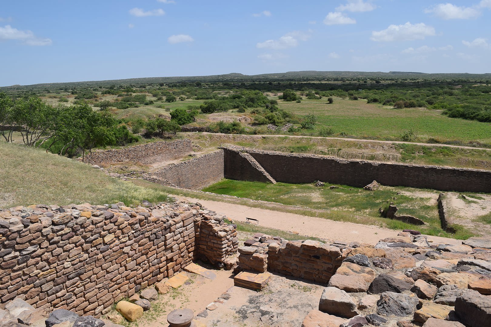
Dholavira in Gujarat, India, is one of the largest cities of Indus Valley Civilisation, with stepwell steps to reach the water level in artificially constructed reservoirs. Photo: Lalit Gajjer
Dholavira in Gujarat, India, is one of the largest cities of Indus Valley Civilisation, with stepwell steps to reach the water level in artificially constructed reservoirs. Photo: Lalit Gajjer
“Both of those sites are very famous. I had assumed that we weren’t going to learn very much about such sites, but the discovery that both of them were surveyed decades earlier was quite a surprise. To be honest, it was also the moment that proved to me that what we were doing was going to work.
“The wow moment was going from realising that it was something that might work to actually seeing it work at a massive scale. We could see things that were staring us in the face — the archaeological mounds are hidden in plain sight.”
There have been similar impactful discoveries for Professor Lane with the MAEASaM project, one of which was in Marsabit County in Northern Kenya around the Chalbi Desert where a dense concentration of stone cairns of different types was identified.

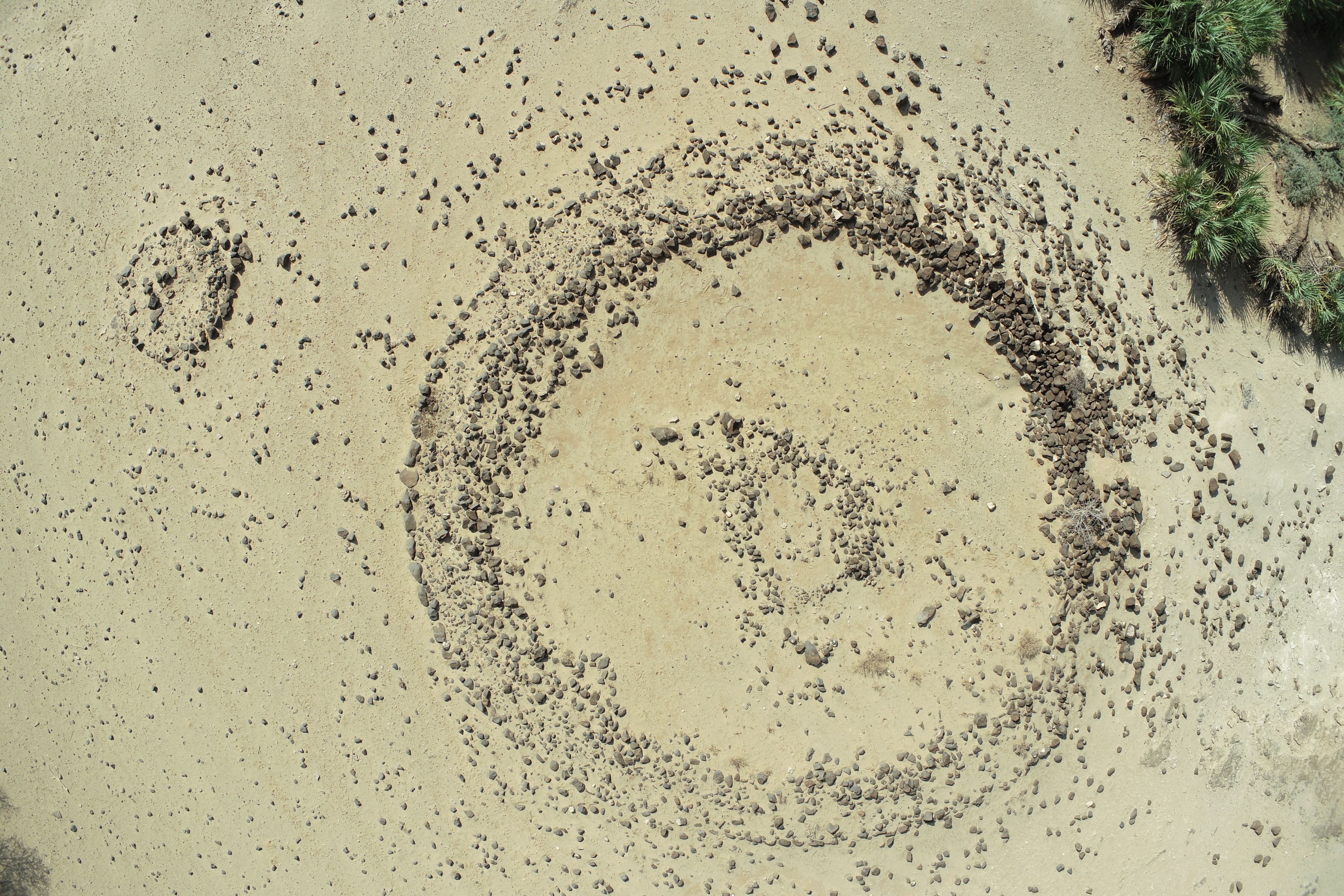
Aerial view of a large ring cairn, Korolle Oasis, Chalbi Desert, Kenya; based on a comparison with excavated examples near Kalacha, these ring cairns likely date to around 900-700 CE. Photograph: John Kanyingi.
Aerial view of a large ring cairn, Korolle Oasis, Chalbi Desert, Kenya; based on a comparison with excavated examples near Kalacha, these ring cairns likely date to around 900-700 CE. Photograph: John Kanyingi.
“We know from the limited number of examples that have been excavated they are used for burial over a span of about 4,000 years, by different groups,” he said.
“We are showing there must be upwards of 6,000 in these just relatively localised areas in a very arid part of Kenya.
“People have known for some time that there were stone cairns present in this area, this was not unknown, but simply the density and the number, nobody had sought to just count them which is what we’ve now done very rapidly working with our collaborators.”
Mitigating future risk with a panoramic view
Both the MAHSA and MAEASaM projects have started to create opportunities to highlight less-known archaeological heritage to a wider international audience.
“All of a sudden, I think we’ve come across something that will bring the archaeology of this region to global attention,” says Professor Petrie, of the MAHSA project.
“We will be able to see this vast panorama of information and I think that is really exciting, both for me academically but also in terms of all of the other stakeholders. The heritage practitioners are going to be in a position to make decisions about archaeological sites that are there.
“They may not be able to save everything, but hopefully they can document everything that is out there or at least findable. That will help them make decisions about what to protect, especially for heritage that is not currently known.
“I think in the end that is really exciting opportunity to be able to share that information with people.”
It is a belief echoed by Professor Lane.
“I think that for the majority of the national authorities, they have recognised the value of the project, first for making security copies of their paper archive of sites and monuments which is 70 to 100 years of information collected by numerous researchers,” he said.
“They are able to use the database to plan for priority interventions. We typically ask the national authorities to identify the areas that they feel might be particularly at risk, or where they know instinctively that they have gaps in their knowledge so they can let us try to fill in those gaps.”
It is felt that the databases will assist countries not just with their monitoring, but by also getting a better handle on the level of loss of archaeological sites.
Professor Petrie describes how India and Pakistan are having dramatic population increases but they are still not as urbanised as many parts of the world — with both countries less than 40 per cent urbanised compared to the global average urban proportion of population being more than 50 per cent.
This increases the future risks and threats to cultural heritage due to growth and development.
“A lot of what we’re doing is a little bit of a race against time because things happen, rivers flood and things get washed away, cities grow and occupy new land, and agriculture expands and intensifies. All those things can destroy archaeological sites,” said Professor Petrie.
There has been an unprecedented interest in the projects from people wanting to be involved, including documentary film-makers.

To find out more about how you can support conservation research at Cambridge, please contact:
Georgina Cannon
Managing Director of Development
Email: Georgina.Cannon@admin.cam.ac.uk